I was delighted that this year two of my images from the flooding rains we had two years ago were selected for display in the Turchin Center for Visual Arts in Boone, NC for the 12th Annual Appalachian Mountain Photography Competition.
Landscape: "Appalachian Storm Surge” by Catherine Hopkins
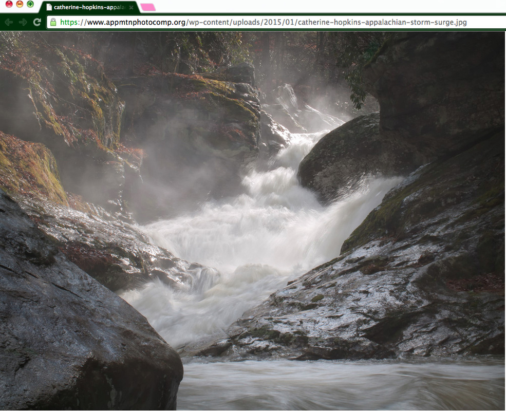
Pictured above in "Appalachian Storm Surge" is the cascade just below 'Trashcan Falls' on Laurel Creek [in Watauga County, NC] in the flooding rains of January 2013. The fog lingered a while after the sunshine replaced the rain. Photograph © Catherine Hopkins, All Rights Reserved.
Our Ecological Footprint: “Slope Sliding Away” by Catherine Hopkins
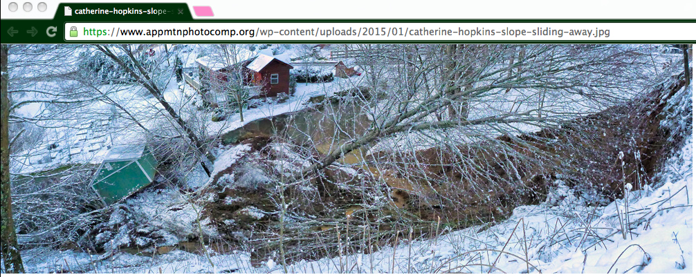
According to the NC Geological Survey, some 300 landslides were documented in western NC during the record rainfall in the first 7 months of 2013. And the vast majority of those slope failures had involved slopes altered by development and mobilized into damaging debris flows. In large part due to steep slope development, Watauga County leads the state in the number of known slides. I learned only after our slide that our home was already depicted in a high-risk landslide site mapped by State Geologists seeking to identify such likely hazards before their funding was cut. In this case, the final trigger was likely the blockage of drainage ditches up above, that redirected the stormwater over a weakened slope. Photo © Catherine Hopkins, All Rights Reserved.
Ah well, I could write an entire blog detailing each grueling stage of the whole landslide experience, which ended up being a two-year journey in and of itself. But for now, suffice it to say that it inspired the trail name I feel called to use: Salix (as in Willow).

 RSS Feed
